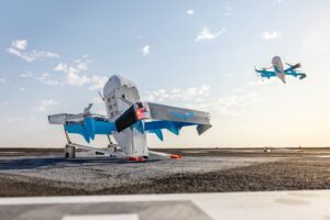
– Redwire Corporation, a supplier of space infrastructure for the next generation space economy, has announced that it has signed a definitive agreement to acquire Edge Autonomy, a provider of field-proven uncrewed airborne system technology. Under the terms of the merger agreement, Redwire will acquire Edge Autonomy for $925 million on a debt free, cash […]
Amazon confirmed that it voluntarily paused its Prime Air drone deliveries in Texas and Arizona, but downplayed the role of a reported crash of two drones in December at an Oregon testing facility as a factor in the decision. “We’re currently in the process of making software changes to the drone and will be voluntarily […]
Now that Joe Biden’s presidency has come to an end, here’s a rundown of the various drones that Washington has acknowledged committing to Ukraine. The Ukraine-Russia conflict has been the most intense two-way drone war in human history, with unmanned aerial systems being employed by both sides on a large scale for one-way attacks and […]
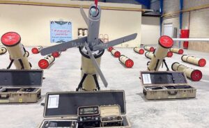
The Islamic Revolution Guards Corps (IRGC) Ground Force has unveiled a new type of suicide drone with a range of 20 kilometers as the military unit continues to upgrade its cutting-edge warfare technology. The loitering drone named “Rezvan” was introduced and operationalized on the final day of Great Prophet 19 military drills by the IRGC […]
HeatSight Delivers Altitude-Based Cellular Coverage Mapping, Transforming BVLOS Connectivity and UAV Operations by DRONELIFE Staff Writer Ian J. McNabb Israeli-based Elsight, a company focused on unmanned connectivity solutions, announced today the launch of HeatSight, a revolutionary signal strength mapping tool which provides reliable data on cellular coverage for more effective and safer UAV flight planning. […]
Innovative Technology Set for Deployment at Jizerska 50 Ski Race T-Mobile Czech Republic and Primoco UAV SE have partnered to create a drone-based mobile signal booster, marking the first deployment of this technology in Europe. The collaboration aims to provide mobile signal coverage in areas where traditional ground-based infrastructure is unavailable or impractical. The system […]
Amazon suspends drone delivery in Texas, Arizona By DRONELIFE Features Editor Jim Magill Citing safety concerns with its model MK30 drone’s software, delivery giant Amazon recently announced it was suspending its drone delivery services at its facilities in College Station, Texas and Tolleson, Arizona until further notice. The company, which in 2020 received its FAA […]
I’m a little late to the news with this one — and that’s the news of DJI launching its new Matrice 4 Series of drones. But hey, over the past couple weeks, I’ve been focused entirely on consumer products. It’s all large due to CES 2025 in early January, which in itself brought a couple new DJI products including the DJI O4 Air Unit series.
And besides all the new CES 2025 products, the new year generally rings in a bunch of new stuff I’ve had my eyes on in the consumer space. Then last week, DJI gave us the DJI Flip, which I haven’t stopped playing with.
Don’t worry, I haven’t forgotten the enterprise space. Hardly. In fact, though it might seem like there’s a newfound focus on consumer products in 2025 based on my coverage, the drone industry is increasingly pivoting toward enterprise applications. And one of the most critical enterprise applications is the concept of Drone as First Responder (DFR) programs.
This month’s release of the DJI Matrice 4 Series marks a significant advancement in the world of drones, particularly for public safety and Drone as First Responder (DFR) programs. Here’s what you need to know about the new DJI Matrice 4 Series — and what it means for the drone industry going forward:
Inside the DJI Matrice 4 Series (and the future of DFR)
All about the DJI Matrice 4 Series: built for enterprise (including public safety)
DJI’s new Matrice 4 Series consists of two products — the Matrice 4T and Matrice 4.
The Matrice 4T stands out with its thermal imaging and starts at $7,299, while the 4E excels in high-speed aerial mapping and starts at $4,799. Here are their key specs:
Both drones are tailored for enterprise use across industries. That includes electricity inspection, forestry conservation, and surveying and mapping. But its features (particularly the thermal capabilities on the 4T) make it particularly well-suited for DFR programs. Here’s how:
Advanced sensing for critical missions
With intelligent sensors like a 24mm wide-angle lens and a 168mm telephoto lens, the Matrice 4 Series captures detailed visuals in both daylight and low-light conditions. This capability is vital for nighttime search and rescue missions or operations in urban environments.
Then there’s the thermal imaging capabilities (though only on the 4T). The infrared thermal camera supports High-Res Mode with resolutions up to 1280×1024 pixels, offering detailed heat maps essential for locating individuals or assessing fire hotspots.
Both versions include a laser range finder, which enables real-time precise measurement. In DFR use cases, you could use it to complete tasks like calculating the area of a wildfire.
Additionally, users can share info via the DJI Pilot QR code or FlightHub 2 with relevant personnel to enhance collaboration and workflow efficiency.
DJI Matrice 4 Series. (Image courtesy of DJI)
Rapid deployment and mission flexibility
The Matrice 4 Series boasts a 15-second emergency takeoff time, ensuring rapid deployment during critical incidents. Its cruise control and automated mapping features allow responders to maintain a consistent search pattern, minimizing the risk of overlooking any areas.
Safety features on the DJI Matrice 4
Equipped with six high-definition low-light fisheye lenses, the drone excels at obstacle avoidance, intelligent rerouting and safe return-to-home operations in challenging environments. Features like electronic dehazing improve imaging in foggy or humid conditions, ensuring reliability in adverse weather.
DJI Matrice 4’s AI-powered tech
Integration with the DJI Pilot 2 app enables real-time visualization of observed areas, reducing redundancy and increasing coverage efficiency. Use that built-in AI model to detect vehicles, vessels, and subjects during search and rescue operations.
Additionally, the onboard AI computing platform allows certified third-party developers to create custom applications tailored to specific needs.
The Matrice 4 Series is poised to be a critical asset for expanding DFR programs, suitable for scenarios ranging from monitoring active crime scenes to aiding in disaster relief.
The drone’s emphasis on privacy is also noteworthy. For sensitive missions, operators can activate Local Data Mode to sever internet connections and protect data integrity. This ensures compliance with stringent security requirements, particularly for government and public safety agencies. And that should also squash some political calls to ban DJI drones (and other drones made in China).
The larger landscape of drones used in DFR
While DJI remains a dominant player in the public safety drone market, other companies like Skydio, BRINC Drone, and Motorola CAPE are contributing to innovation in the field. Skydio’s autonomous capabilities, for instance, have gained traction among law enforcement agencies for indoor navigation during building clearances due to products like Indoor Capture, which is a Skydio 3D Scan modespecifically tailored for autonomously scanning large, complex, indoor environments. Competitors like BRINC Drones lean into specialties (in BRINC’s case, that includes specializing in drones designed for hostage and barricade situations).
Nevertheless, DJI continues to set industry standards with its comprehensive ecosystem. The Matrice 4 Series, supported by the D-RTK 3 Multifunctional Station and accessories like the AL1 Spotlight and AS1 Speaker, offers a level of versatility that is hard to match.
DFR: A revolution in public safety
Barry Brennan, Flying Lion President & Founder, provides Drone as First Responder (DFR) Tactics Training to the Santa Monica Police Department. Photo courtesy of Flying Lion.
Since the Chula Vista Police Department launched the first DFR program in 2018, drones have become an indispensable tool for law enforcement and emergency response. These programs allow drones to be dispatched to incident scenes ahead of ground units, providing real-time aerial intelligence that enhances situational awareness for first responders.
According to Skydio’s Drone as First Responder (DFR) report from January 2025 the most common type of DFR calls involved burglary, retail theft, vehicle theft and robbery. In most of those cases, the drone was dispatched to the suspect’s location, typically beating the responding officers. Their more prompt arrive has generally allowed drones to guide officers to the suspect. For that study, Skydio looked at 1,779 DFR flights conducted between September 15, 2024 and November 14, 2024 that used Skydio DFR Command. And Skydio added that — in most of those flights — the suspect was successfully apprehended.
According to Flying Lion, a leading drone service provider, drones in DFR programs arrive on scene 74% of the time before ground units, often providing critical insights that influence tactical decisions.
By the end of 2024, Flying Lion reported over 55,000 DFR flights, with more than 35,000 conducted Beyond Visual Line of Sight (BVLOS). And in 2025, DFR programs are expected to soar.
“We expect DFR programs will more than double in 2025,” said Flying Lion’s president, Barry Brennan.
Looking ahead: 2025 and beyond
As DFR programs double and municipalities invest in drone technology, the DJI Matrice 4 Series could play a pivotal role in shaping the next era of public safety. Its combination of intelligent features, rapid deployment, and robust privacy controls aligns with the growing demands of first responders.
The Matrice 4 Series could be a key example of how drones are for more than just taking pretty pictures. They can be a tool for saving lives. With communities increasingly relying on drones to enhance safety and efficiency, this latest innovation from DJI underscores the transformative potential of drones in public safety. As 2025 unfolds, the Matrice 4 Series is likely to become a cornerstone of DFR programs nationwide, setting new benchmarks for what’s possible in emergency response.
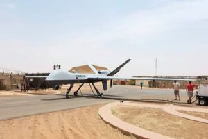
France has retired its General Atomics Aeronautical Systems Inc (GA-ASI) MQ-9 Reaper Block I unmanned aircraft system (UAS) in favour of the MQ-9 Reaper Block 5 Extended-Range (ER) UAS. The French Air and Space Force (l’Armée de l’Air et de l’Espace: AAE) announced the transition on 21 January, noting the conclusion of 11 years of […]

 – Redwire Corporation, a supplier of space infrastructure for the next generation space economy, has announced that it has signed a definitive agreement to acquire Edge Autonomy, a provider of field-proven uncrewed airborne system technology. Under the terms of the merger agreement, Redwire will acquire Edge Autonomy for $925 million on a debt free, cash […]