Enhanced Processing Speed and New GPS Feature Boost Accuracy for Construction, Surveying, and Public Safety by DRONELIFE Staff Writer Ian J. McNab Telemetry software developer SkyeBrowse recently announced a major update to their flagship product, bringing them substantially closer to their stated goal of creating truly real-time 3D models using UAV assets. As part of […]
Lithuanian Startup’s Cutting-Edge UAVs and Gimbals Set to Revolutionize Reconnaissance Missions Amid Ukraine Conflic Granta Autonomy, a Lithuanian startup specializing in fully autonomous UAVs for intelligence, surveillance, and reconnaissance missions, has successfully completed a €1 million seed funding round. The funding, led by ScaleWolf VC with participation from Brolis Defence and HFL Holdings, will enable […]
The use of drones in construction has demonstrated a key example of how drones make industrial applications more efficient, safe and cost-effective. So what is the best drone for construction?
Once you consider price versus specs, the DJI Mavic 3E comes out on top. But there are tons of other players in the growing segment.
And yes, the construction segment is still growing strong. According to fresh data from German-based analytics group Drone Industry Insights (DII), construction ranks second among all industry verticals that use drones. That’s according to the group’s Drones in Construction Market Report, which was released in June 2024.
While the market for drones in construction is worth an estimated $4.8 billion currently, indicators suggest it could grow to $6.2 billion by 2024. That makes for a compound average growth rate (CAGR) of 4.5%. That’s just ahead of the agricultural drone industry, which is worth $3.6 billion in 2024.
Interestingly, that’s actually lower than the estimated CAGR for the drone market as a whole, which is expect to grow at a CAGR of 7.1% to be worth $54.6 billion by 2030. But it’s not for lack of interest in using drones for construction. Rather, it’s that interest is already high, that there isn’t much room to grow, DII’s data suggests.
DII shared a neat graphic about drones in construction, that goes a long way to sum up the industry highlights in one chart:
Graphic courtesy of Drone Industry Insights
The ultimate guide to using drones in construction
Improved Site Planning and Surveying: Drones equipped with high-resolution cameras and LiDAR technology can rapidly capture detailed aerial imagery and topographical data. The growth of reality capture software from companies like DroneDeploy and Pix4D has made these use cases even more prevalent.
Data generated via drones in tandem with such software can then build survey-grade accurate and geo-referenced orthomosaics, points clouds, 2D maps, and 3D models for analysis, inspections, and measurements. These images, maps and measurements aid in accurate site surveying, helping construction teams to plan effectively and identify potential issues early on.
Enhanced Safety Monitoring: Drones enable construction managers to remotely monitor job site safety, assess hazardous conditions, and ensure compliance with safety regulations without risking human lives.
Progress Tracking and Reporting: Real-time aerial data allows for better project tracking and reporting. Construction progress can be monitored regularly, reducing delays and optimizing resource allocation.
Cost Efficiency: By reducing the need for manual inspections and surveying, drones lower operational costs while increasing overall project efficiency. This cost-effectiveness extends to maintenance inspections, where drones can swiftly inspect hard-to-reach areas like rooftops and bridges.
Marketing and Stakeholder Engagement: Aerial photography and videography captured by drones provide compelling visual content for project marketing and stakeholder presentations, enhancing client engagement and investor confidence. For example, did you see that Apple Campus 2 drone footage? And what about that preview of Hong Kong Disney’s Frozen land? Aerial construction videos definitely help build hype.
The best drones for construction in 2024
Choosing the right drone depends on specific project requirements, budget considerations, and the desired functionality. Here are some of the top drones favored in the construction industry:
DJI Mavic 3E: best overall for mapping and modeling
Drone makers are leaning into enterprise drones, such as DJI’s Mavic 3 Enterprise, to hedge against the hobby drone market shrinking.
The DJI Mavic 3E stands out as a runaway leader in a ranking of the best drones specifically for mapping and modeling. In fact, drone mapping software company DroneDeploy said that the roughly-$4,000 DJI Mavic 3E is easily the No. 1 used drone for reality capture.
When you factor in the features relative to the price tag, it’s easy to see why this one comes in as best overall.
Key Features of the DJI Mavic 3E:
Launched in October 2022, the DJI Mavic 3 Enterprise took the shell of the existing Mavic 3 drone, but leveled it up with way fancier tech, including:
56× zoom camera
45 minute flight time
Mechanical shutter
100W fast charging and a three-battery 100W charging station
RTK module
Advanced obstacle avoidance (APAS 5.0 enables automatic rerouting around obstacles)
What is the DJI Mavic 3E best for?
Large-scale construction projects requiring precise aerial inspections and mapping. That’s all due to the drone’s RTK module. Short for Real-Time Kinematic, RTK is critical for building models with centimeter-level precision — which is almost always a critical component of any construction project.
With the Mavic 3E’s RTK module comes support for network RTK, custom network RTK services, and D-RTK 2 Mobile Station (that’s DJI’s upgraded high-precision GNSS receiver that supports all major global satellite navigation systems, providing real-time differential corrections).
It also has basically the best of what every other drone in this guide promotes as their standout feature. Like the Phantom 4, it’s got a mechanical shutter. At 45 minutes of flight time, it’s not the longest, but it’s still pretty long.
Consider it a combination of the best features of every other drone here — hence it’s the winner of best overall drone for construction.
The big drawback here is the name tied to it — DJI. DJI has been facing an uphill battle lately primarily among Republican politicians who are seeking to ban Chinese-made drones through legislation like the American Security Drone Act of 2023, which would prohibit federal agencies from purchasing drones made by Chinese government-linked countries. Even more strict is the proposed Countering CCP Drones Act, which could ban DJI drones if passed. But hey, maybe that just means you should buy a DJI drone now, before they potentially become incredibly tough to come by in the U.S.
You also have to consider that we factored price into our calculations. At about $4,000, the DJI Mavic 3E is affordable to a small startup or sole proprietor. Do realize though that other drones in this guide are more advanced, with features like thermal applications that the Mavic 3E can’t do (there is a roughly-$6,000 Mavic 3T, with T for thermal, though if that’s the specific feature you need). If you’re picking a drone for a larger company — or just generally have a bigger budget — you can afford to do better.
DJI Matrice 300 RTK: best for thermal applications
Equipped with the Zenmuse H20/H20T camera options, the DJI Matrice 300 RTK stands out not just for its visual cameras (offered as both zoom and wide-angle cameras) but also for its thermal imaging capabilities.
It costs nearly $14,000, but even still the demand is far higher than the supply. At most drone dealers, it’s still on backorder and won’t be available for sometimes close to a month after placing your order.
Key Features of the DJI Matrice 300 RTK:
Dual-camera system (Zenmuse H20/H20T)
Up to 55 minutes of flight time
Advanced AI capabilities for automated inspections and intelligent flight planning
Robust weather resistance in harsh conditions
What is the DJI Matrice 300 RTK best for?
They call it “the cyber workhorse” — and the name is fitting. With up to 55 minutes of flight time, advanced AI capabilities and multi-directional obstacle sensing, the M300 RTK is an incredible combination of strong and smart. This drone is basically the perfect peak of both brains and brawn.
Especially given the powerful transmission system that transmits up to 15 km away, the Matrice 300 RTK is best suited for large-scale construction projects requiring precise aerial inspections and mapping.
Drawbacks of the DJI Matrice 300 RTK
Much like the concerns about Chinese government ties that the DJI Mavic 3E contends with, the DJI Matrice 300 RTK grappes with those same, aforementioned challenges.
Plus given that the Matrice 300 RTK costs $14,000 but the Mavic 3E is only about $4,000, there’s a huge price difference to contend with.
And finally, you might also consider the DJI Matrice 350 RTK, which is a slightly newer model to the beloved Matrice 300 RTK. Debating between the DJI Matrice 350 RTK vs Matrice 300 RTK? Check out my comparison guide.
It’s true: the DJI Phantom 4 is still the reigning king in photogrammetry. And it stands out for a few reasons, which are:
Cost: this powerhouse is the cheapest of any drone in this guide at just about $2,000
Mechanical shutter (better for overcast days)
DJI Terra and DJI Modify software
Read on for a deep dive into the DJI Phantom 4’s best specs:
A screenshot shows how 3D models can be edited in DJI Modify. Image courtesy of DJI.
Key Features of the DJI Phantom 4:
Camera with 1-inch 20MP sensor
Five-directions of obstacle sensing
Video processing support for H.264 4K videos at 60fps or H.265 4K at 30fps, both with a 100Mbps bitrate
30 minutes flight time
What is the DJI Phantom 4 best for?
Even though this drone came out in 2016 (which is ancient in drone years), it’s tech is in some ways better than more modern drone technology. That in large part has to do with the Phantom 4’s mechanical shutter, which is critical in reducing motion blur (a problem especially pronounced on overcast days).
It’s your best bet if you want to use DJI Terra, which is a DJI-made software designed to take existing 3D models and repair minor defects in them. And even though the DJI Phantom 4 is an older drone, DJI has been constantly improving on the Terra software. In fact, at the beginning of the year, DJI launched an enhanced software called DJI Modify, which brings an intelligent 3D model editing component into DJI Terra.
The drone is so old, that you might find it out of stock. It’s out of stock on DJI’s own story, though you can find it through major retailers like Amazon.
The aircraft itself is also not as powerful as other picks in this guide. For example, it offers a relatively-low 30 minutes of flight time. And as far as obstacle sensing goes, it was a huge leap when the Phantom 4 launched back in 2016. In fact, it was the first drone I ever flew with obstacle sensing; this tech was unheard of in consumer drones. But these days, the tech is way better, with full, omnidirectional sensors that can intelligently navigate around obstacles much better than the Phantom 4 can.
And once again, don’t forget about those anti-China, anti-DJI concerns that keep bubbling up.
Sony Airpeak S1: best for carrying Sony Alpha cameras
Sony originally made the Sony Airpeak S1 drone to carry its Alpha series of cameras, which largely appeal to high-level cinematograpers. But while Sony initially envisioned its drone as appealing to Hollywood, the drone has turned heads in the industrial side. So much so, that in April 2023 Sony launched critical updates to its drone that were all enterprise oriented, including the addition of an RTK GNSS system for the Airpeak S1.
Key Features of the Sony Airpeak S1:
Customizable in allowing you to pick the Sony Alpha camera you want
Might be more affordable if you already own a Sony Alpha camera for other use cases
Wind Resistance up to 44.7 mph
RTK GNSS system
Obstacle avoidance and braking
Up to 55.9 mph Maximum Flight Speed, plus wind resistance up to 44.7 mph
What is the Sony Airpeak S1 best for?
Even though it was originally marketed toward cinematagraphers, the Sony Airpeak S1 has become a dream for precision mapping.
It’s especially great for people who already own any Sonya Alpha cameras, as you can potentially save money by not having to buy a separate sensor just for a drone. Plus, you can use that Alpha camera for more than just aerial photos — which isn’t the case across drones that have built-in cameras. Among those include the beloved ILCE-7C (Sony Alpha 7C Full-Frame Mirrorless Camera).
The drone is also super powerful, capable of flying at high speeds and in high winds. Just spend the day flying with Sony test pilot Craig Coker as proof.
For mission planning, Sony’s drone best works with AirData UAV. AirData’s software generates drone data analytics and executes UAV fleet management for mission planning.
Price is a huge factor here. On the surface, the Airpeak drone itself costs $9,000, but it’ll end up costing you more like $20,000. That’s because you’ll still need your own camera and lenses. And should you need a gimbal, that’s also not included. Budget an additional $2,000+ for the gimbal, between $1,800 and $6,500 for the camera body, and at least $1,000 for the lens.
Another big bummer with this is the weak battery life. Even though Sony followed up its initial launch with a far more powerful 3,938mAh Enhanced Battery, that still only increased the battery life from 22 minutes to just 30 minutes — and that’s without a payload. If you’re using a standard payload kit, say, the RTK Kit, PX1 gimbal, an A7RIV, and the Zeiss 35mm F2.8, then expect average flight times to drop down to 20 minutes.
SenseFly eBee X: best for long flight times
While more 80% of the drones used in construction are multirotor drones, according to DII’s reporting, some fixed-wing drones serve a powerful niche for massive sites. That’s all due to their inherent power in executing longer flight times. And with that, SenseFly’s eBee X ranks among the best fixed wing drones in construction if you demand long flying times.
On-demand RTK for highly accurate survey-grade mapping capabilities (1.5 cm / 0.6 in absolute accuracy)
What is the SenseFly eBee X best for?
For pilots seeking a lightweight, long-range drone, the eBee X is your pick. And yes, light weights make the drone able to fly longer and more portable, but it also comes with regulatory advantages. In fact, the eBee X is approved to run Operations Over People (OOP) in both Canada and the U.S., which is critical for urban construction sites.
This drone is actually surprisingly easy to fly, so it could cater well to people who aren’t drone pilots at heart. It takes off via an easy hand-launch, and it flies in an automated path using the eMotion mission planning software, which is included. And though that software does have advanced features, it’s actually quite beginner-friendly.
Drawbacks of the SenseFly eBee X
As is the case with most fixed wing drones, it can be difficult to make a precise landing — and even the beginner-throw is only possible if you throw it right. The eBee X often can be difficult to launch without wind. As far as landing, the drone often ends up skidding if landing on gravel or brush, which can damage the drone. You’ll also need a long landing area, which likely won’t work in urban areas.
Additionally, the sensors just aren’t as powerful as most of the other drones in this guide — especially relatively to the flexibility of powerful sensors you could opt for in something like the Sony Airpeak X1 drone.
One more note: Though we’re calling out the eBee X here , you also shouldn’t overlook another solid pick, the Sensefly SODA. Made in Switzerland, the SODA drone is known for its rugged design, long flight times, and compatibility with various sensors, making it ideal for large-scale mapping projects.
Skydio X10: best for navigating complex environments autonomously
Photo courtesy of Skydio
The Skydio X10 makes use of advanced AI technology to navigate complex environments — all without a pilot (and generally better in terms of flight path optimization than what most human pilots would do anyway).
Launched in late 2023, the Skydio X10 also stands out for its high-resolution cameras, lightweight portability and powerful airframe. Plus, it’s the only pick in this guide that’s made in America
Key Features of the Skydio X10:
Among the key Skydio X10 features include:
Multiple cameras: 48 MP Zoom Camera, 50 MP Wide Field of View Camera and 640×512 FLIR Boson+ Radiometric Thermal Camera
NightSense: software designed to enable autonomous flight even in zero-light environments
Durable airframe: IP54 weather resistance rating, modular and open style with four payload bays
Safety features to prevent drone jamming: It’s called Skydio Connect, and it’s a connectivity system with a redesigned point-to-point link. The system uses a multi-band radio which is critical for flying in contested and jammed environments.
What is the Skydio X2 best for?
At more than $10,000, this is going to be an ultra-high end drone for someone with deep pockets. Simple mapping projects don’t need something this robust, but this drone stands out if you’re seeking something more versatile for perhaps even other applications like first response, critical infrastructure inspections or even military applications.
If you’re solely committing to using it purely for construction, it’ll best stand out in complex construction sites with dynamic obstacles, dark lighting conditions, and/or tight spaces.
Cost is a big one, necessitating a higher initial investment compared to consumer-grade drones. In fact, many critiques say it’s overpriced relative to its capabilities.
There are also a few weaknesses compared to other picks here such as flight times. This one’s maximum flight time is a moderate, 40 minutes.
Comparing the best drones for construction
Here’s how the best drones for construction compare:
Mapping and drones in construction go hand-in-hand. To learn more about whether it’s worth getting into drones in construction, start off with a drone mapping course.
These can be a low-commitment, affordable way to dip your toes in. For example, Drone Launch Academy’s Drone Mapping And Modeling Fundamentals course costs just $400. The course teaches you how to collect and process data using easy-to-fly (and easy-to acquire) drones like a DJI Mavic 2 Pro or a DJI Phantom 4 Pro V2.0, which is called out in this guide as one of the best drones in construction.
The results of AAUS‘ RPAS Industry Survey for 2024 are now available to download from the AAUS website. The objective of these surveys is to gain feedback from industry and use that information to guide our advocacy strategy to meet the needs of our members and the constantly evolving industry. From the data we received […]
.Embention, suppliers of autopilots and critical avionics systems for autonomous vehicles, has announced that it has joined the HAPS Alliance, a non-profit association dedicated to building a high altitude platform stations (HAPS) ecosystem that brings digital sensing and connectivity to everyone, everywhere. As a member of the HAPS Alliance, Embention will collaborate with world-leading telecommunications, […]
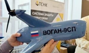
Russian company Red Line has unveiled a high-speed combat drone designed for intercepting enemy unmanned aerial vehicles (UAVs). The relevant development regarding the unveiling of the Vogan-9SP combat drone was confirmed by a company official to the state-owned agency TASS during the “Technologies of Detecting and Countering UAVs” conference, which is currently underway in St. […]
.RigiTech has announced a significant milestone in the United States, after completing the first flight Beyond Visual Line of Sight from the pilot (BVLOS), in partnership with Upstate Medical University’s Air Upstate drone program and Causey Aviation Unmanned, marking a crucial advancement in the transport of time-sensitive medical materials. Over the last few months, Air […]
Agreement Aims to Enhance Tourism and Urban Development through Advanced Air Mobility SkyDrive Inc., a prominent Japanese eVTOL aircraft manufacturer, and Kyushu Railway Company (JR Kyushu) have entered into an agreement to conduct a feasibility study for the deployment of eVTOLs in the Kyushu region. This SkyDrive and JR Kyushu partnership seeks to explore the […]
Pennsylvania-Based Company Highlights Rapid Growth and Advanced Technology in Physical Security Industry by DRONELIFE Staff Writer Ian J. McNabb Pennsylvania-based unmanned systems developer Asylon Robotics recently announced that they have completed over 100000 missions using their DroneDog™ system, underlining its creative approach towards the physical security industry. Deploying in areas including critical infrastructure, logistics, manufacturing […]
Upgrade Moves Towards US Manufacturing A2Z Drone Delivery, Inc., a developer of commercial drone delivery solutions, has announced an upgrade to its flagship delivery drone, the RDSX Pelican. The new enhancement features an open-source flight controller, allowing for easier integration with third-party payloads and software systems. This upgrade is a significant step toward the company’s […]